


Adventures: The Dragoon Mountains (Arizona)
A chronicle of my visit to the Dragoon Mountains, site of Old West gunfights and Cochise's stronghold in southeastern Arizona

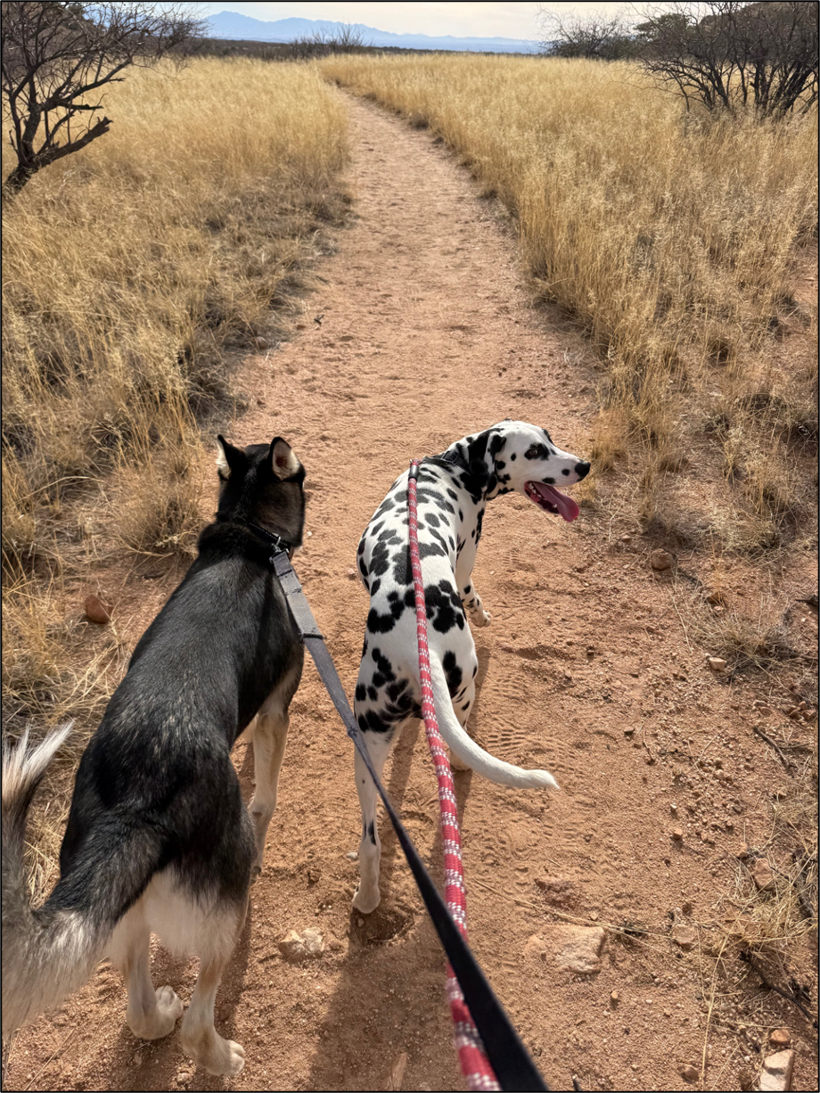
This past week, I took our Dalmatian, Winston, and German Shepherd mix, Rocket, on a hike in the Dragoon Mountains on the Slavin Gulch trail:


The Dragoons are named after the military units stationed in the area in the 1800s that battled against the Native tribes. The warrior Cochise, for whom Cochise County (the site of the Dragoons and other Old West locations) is named, holed up in the Dragoons and is supposedly buried in them, though no one knows where since the Natives who buried him took that secret location to their own graves.
I’ve driven past the Dragoons countless times, not only now that I live near them, but also when I was a younger man and an Army officer stationed at nearby Fort Huachuca for two training assignments. Until Tuesday, I had never set foot in the range, which is about 43 miles long north to south and 35 miles across east to west. The dogs and I set out to take a 6.8-mile hike, but Winston apparently didn’t get the message. He vomited on the floorboard within the first two miles of the drive, which should have been about 1 hour and 20 minutes in total, and then was stricken by a bout of diarrhea, which mandated a pause at a rest stop for cleanup about a half hour in.
From there we rolled down Highway 80 until we exited on Middlemarch Road, one of Arizona’s scenic routes, just north of Tombstone, the town “too tough to die.” For about 20 miles, we bumped our way down the rocky dirt road in our SUV and pulled up to the start point of the trail on a very poorly maintained side road in the Coronado National Forest.

The trail, which begins in the foothills of the range, is dusty and flat for about the first mile before it begins to climb. At that point, it turns into a rocky path with large boulders and steep rock walls to both sides, though I wouldn’t consider the trail unsafe.


About 1.7 miles in, we stopped for a water break, and Rocket downed a quart in what seemed like seconds. A leash wound up clipping the stainless-steel bowl, sending it clanging down from the rocks; while this seems like a trivial detail, it traumatized Winston, who is only nine months old, badly enough that he refused to take any water (beef sticks were still OK). We continued down the path for another half-mile before I located another shady spot, where I wanted Winston to break his thirst strike.
Instead, he wound up succeeding in slipping his head out of his collar and took up a jog back toward the start point. I eventually managed to catch up to him and con him back into his restraints, but only after he had turned us back almost a half mile; since I didn’t want to run out of water in a desert mountain range, I relented and decided to head back to the start point.
On the way back, I put my drone up and got the best picture of the day, with the sunlight hitting just right as we look from east to west over the range, with a view of the Whetstone Mountains in the distance:
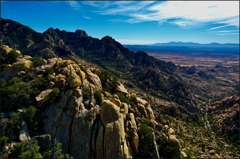
We made it back to the start point late in the afternoon, then went back to Middlemarch Road, cut through the southern end of the mountain range, and came out on the east side of it. After making our way back to I-10, we zipped back to Tucson and fired up the grill. We didn’t get all 6.8 miles (only 4.4) in thanks to Winston’s about face, and therefore left about 600 feet of vertical climb unfulfilled, but this was easily the longest hike of either dog’s life, and a lot of fun off the beaten path. Here is some drone footage highlighting the rugged terrain:
If you want to rummage around the Dragoons, you’ll need to commit most of a day to getting in and out on the primitive roads and exploring around. The trail isn’t bad, and on a clear day, you’ll have great views like I’m showing you with my pictures here.

Seth Keshel, MBA, is a former Army Captain of Military Intelligence and Afghanistan veteran. When he’s not taking heat for his political opinions, he’s intent on living life as fully as possible, taking adventures, and finding new ways to appreciate the road less traveled in pursuit of Freedom.
Just watched your drone footage. I hiked all through there in my late teens and early twenties, but looking at it through my almost seventy-year-old eyes I am struck at how rugged the terrain can be in places. Those must have been some vicious Indian wars back in the day.
My old stomping grounds😁. I was raised in Willcox, which is very close to Cochise Stronghold. God’s country….next to Wickenburg of course. Sorry about the pup.