


Adventures: Carr Peak (Arizona)
A Sunday scramble to the top of the second-highest peak of Southern Arizona's Huachuca Mountains - with a clear view of many American and Mexican mountain ranges and one dehydrated hiking buddy.

Rachel and I decided to go for a Sunday hike with our two dogs, Winston and Rocket, yesterday. We had initially planned to go for Mount Wrightson, the highest peak in the Santa Rita Mountains, which loom large to our south; however, we called an audible at the last minute because we didn’t want to roll the dice on taking the dogs on an 11-mile hike without first testing something in a more intermediate range. When we got down to Sonoita, we wound up zipping off to the southeast toward Sierra Vista and my old military stomping grounds, Fort Huachuca, which sit just a stone’s throw from the Mexican border.
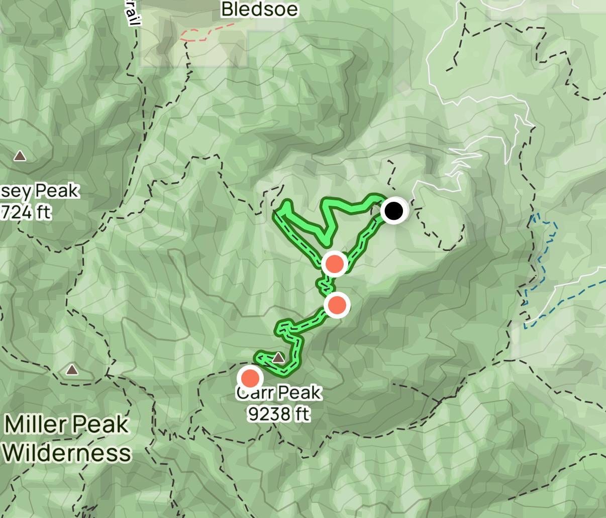
Our target: Carr Peak, at 9,238’, the second highest peak in the Huachuca Mountains.
March in Arizona means the snakes are starting to come out, though we didn’t run into any on our journey to the peak. The drive to the start point takes one through Sierra Vista, population 45,000, and onto Carr Canyon Road, which turns quickly to dirt and makes its way roughly five miles into the mountains. We pulled off as directed by our All Trails app, one of the best apps in existence, leashed up the pups, and took off, loaded out with snacks, water, sunscreen, and .45 ACP-firepower for dealing with any large wildlife or any other immediate emergency.
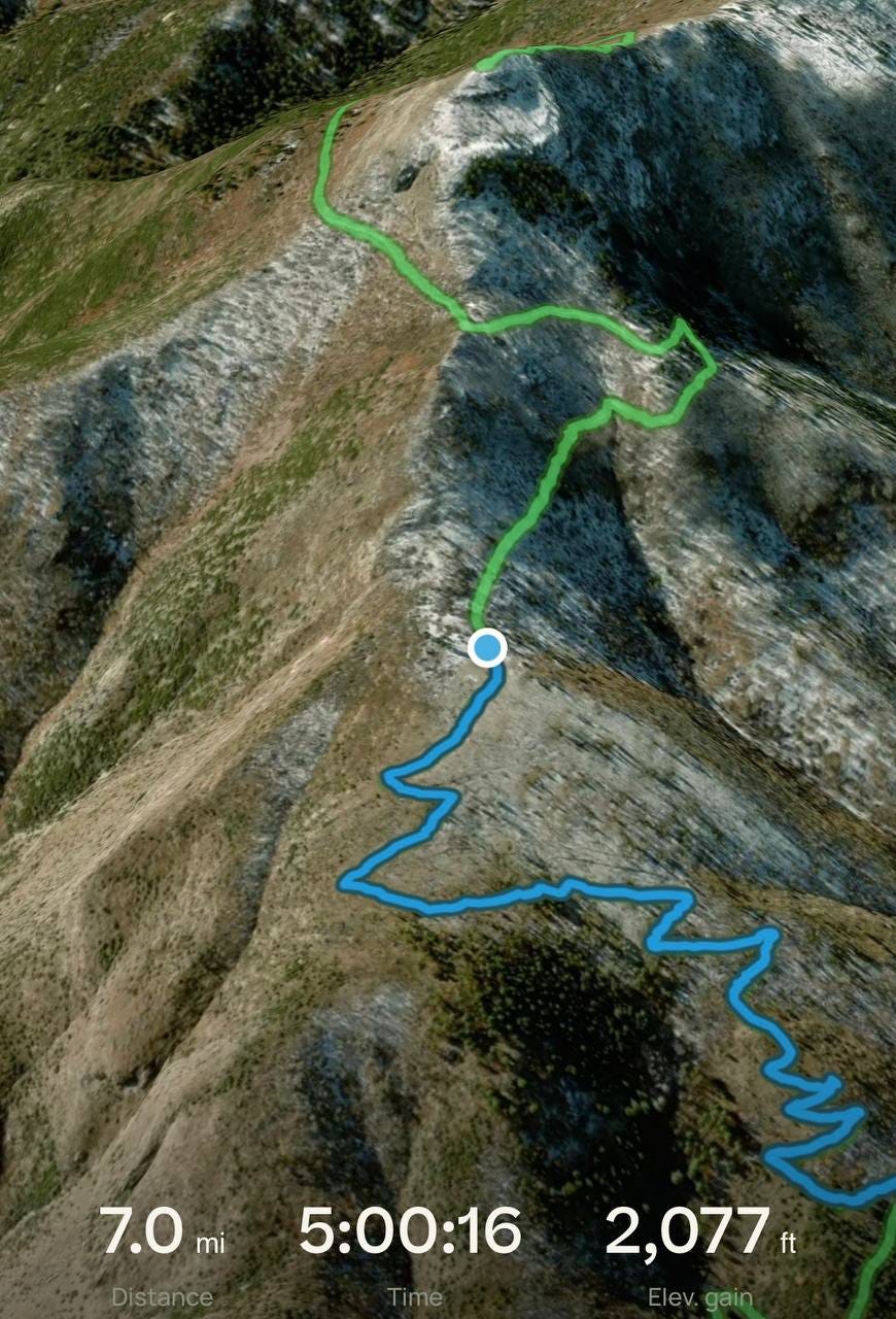
We only climbed about 200’ in the first 1.5 miles of the roughly 2,100’ we would climb to the peak, and once on the main trail to the peak, encountered the loose, rocky footing and switchbacks that make the trip to the top a challenge. This is certainly not a trail for beginners, although I wouldn’t reserve it for experienced hikers, either. At about 8,000’ altitude, the vegetation was overgrown and required a lot of “breaking brush” and embracing the scrapes that come with it. The pups went under most of these, and I had to watch for high clearances that don’t bother most people.
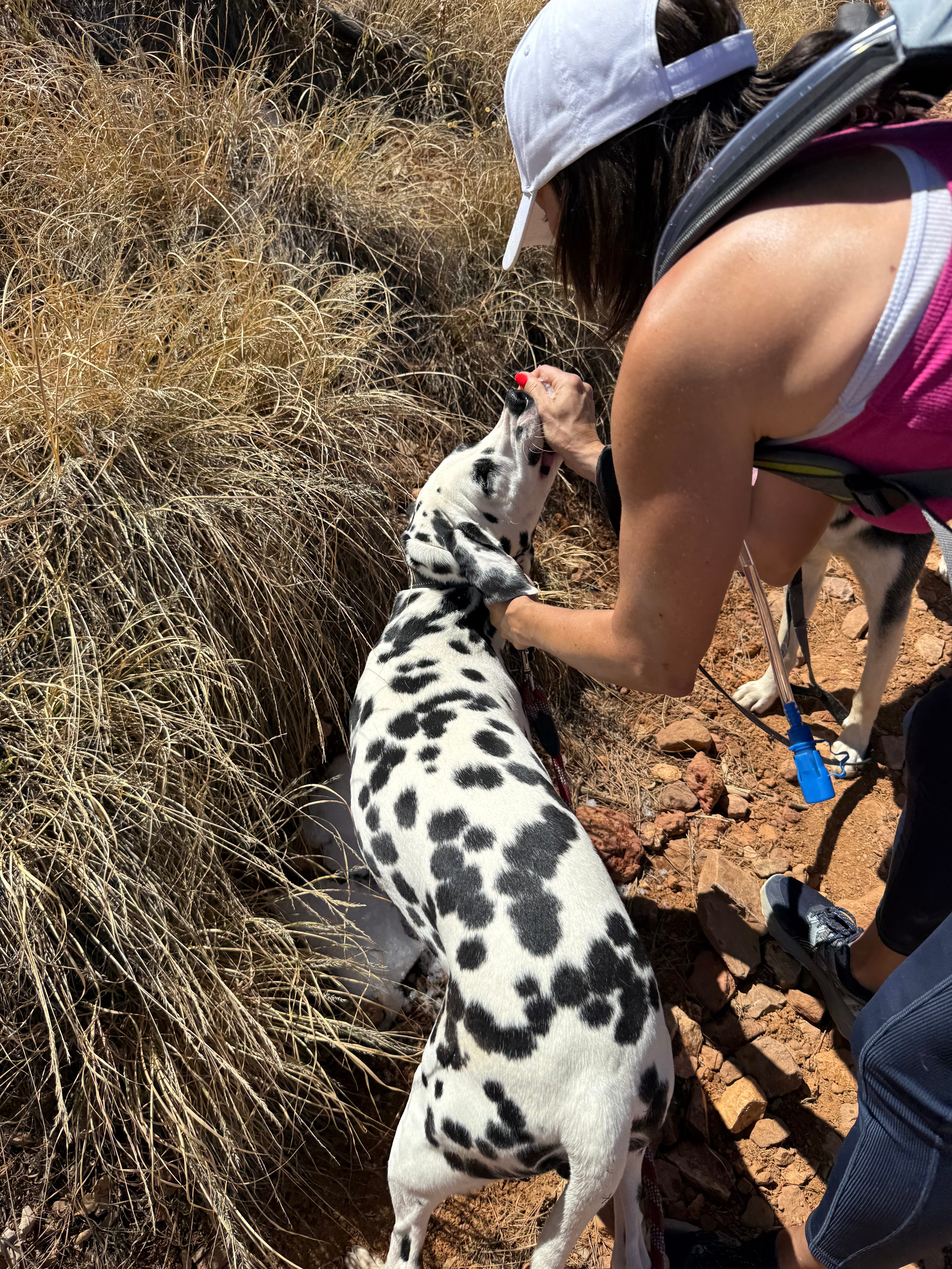
Snow lined much of the shadier, cooler pathways, and that was a good thing. A major logistical challenge we faced was in hydrating Winston, our 10-month old Dalmatian. In my recent journey to the Dragoons, I documented the origin of his fear of bowls and thirst strike mentality, and unfortunately, time has not healed those wounds. He was, however, willing to eat snow as he panted his way to the top, eventually needing to be prodded to keep moving.
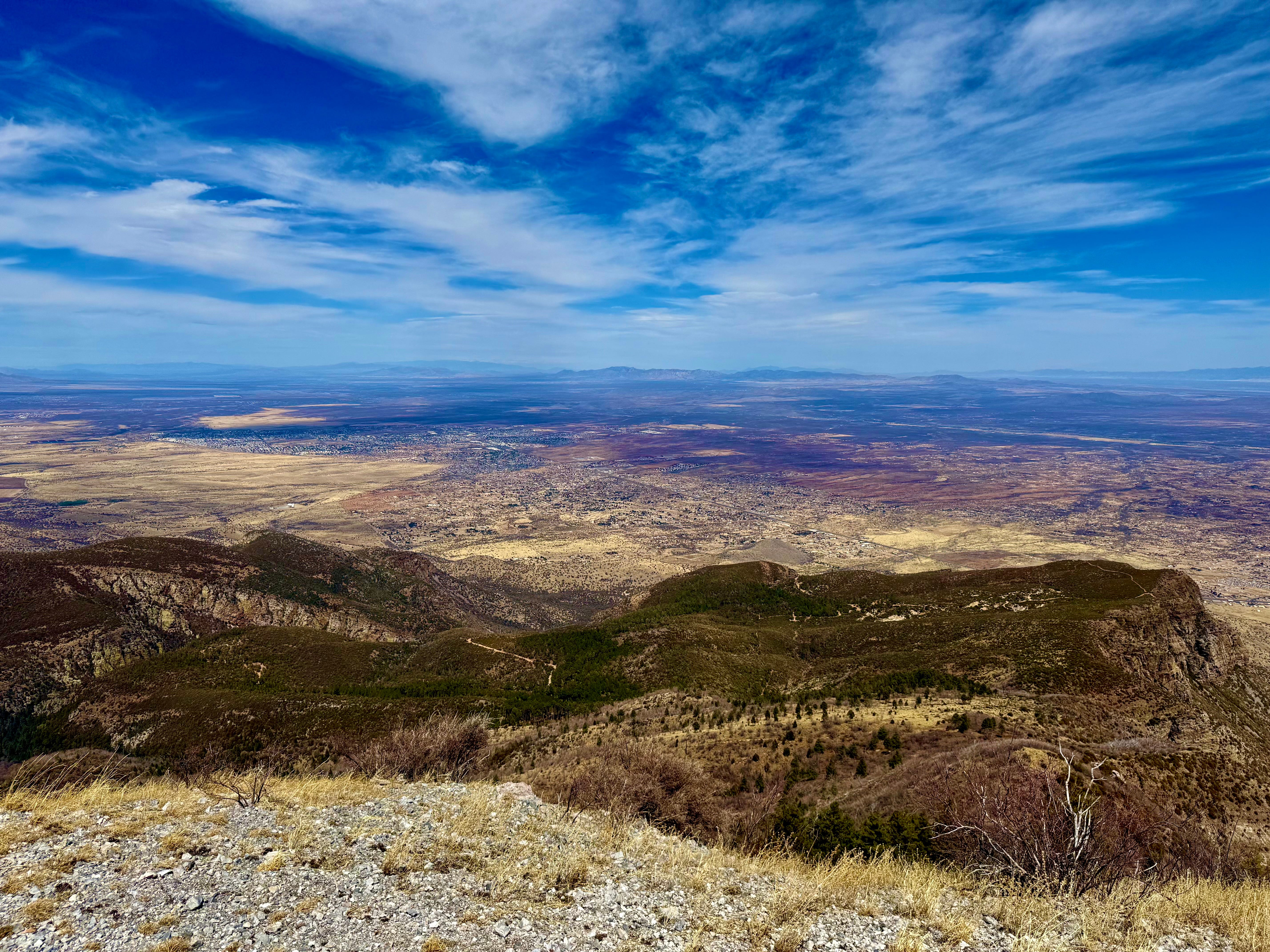
Rocket had no issues obeying orders to hydrate, and as such, proved a capable hiking partner. The climb grew wearisome after about 1,500’ of gain, but with the summit in view, we kept on moving. When we reached the top, we had it to ourselves for about 15 minutes and enjoyed the partly cloudy view with Sierra Vista over 4,000’ below, and views of the Mule, Whetstone, Santa Rita, Dragoon, and Chiricahua ranges all around, and even some peaks in neighboring Mexico beyond the border.
I put the drone up at the peak and got some beautiful shots, including one of Miller Canyon and the highest peak in the range, Miller Peak (9,469’), which I once stood atop as a young military officer in 2008:
With little shelter from the intense sunlight, we made our way back down, a welcome relief to the steady climb that accompanied our ascent. We ran into several soldiers on temporary duty at Fort Huachuca, and stopped for the one dog we have willing to take water from a bowl to refresh himself.
With Winston panting and dragging behind, we took a shortcut we had identified on the way up that cut a little over a mile off the proposed out-and-back route. It took us over some rough terrain with slippery, loose rocks and also past the remains of what appeared to be a fox that had run into a much larger, more vicious member of the Huachuca Mountains wildlife community. We made it back to the truck right at the 7.0-mile mark, with 5 hours of hiking, eating, resting, and sightseeing accounted for. Rocket, undeterred, continued living his best life on the way down the mountain and into town, while Winston fell immediately into a deep sleep:
This was a fun hike, although somewhat strenuous with a lot of uphill climbing. I am sore as I write this, and I’m someone active and in good shape. This should be no issue if you’re a regular hiker and something you can work up to in a matter of a few hikes if a novice, but be sure to take plenty of water and take your time navigating some of the rocky terrain that marks the route to the top. I recommend getting an early start so you’re not dealing with a hot sun on the way up to enjoy the incredible view.
Seth Keshel, MBA, is a former Army Captain of Military Intelligence and Afghanistan veteran. He is intent on living life as fully as possible, taking adventures, and finding new ways to appreciate the road less traveled in pursuit of Freedom.
Fun!
Good memories with my family, too. Our backyard in SV had gorgeous views of the Huachucas and the desert.
For the bowl-averse doggie, how about a large syringe, like those big green bulbs used to irrigate ears, filled with a liquid he likes?
Thanks for sharing your hiking adventure! I will always miss AZ. Lived in Scottsdale and FLG!
Did a lot of hiking alone in FLG! A safer time and I was well equipped with water!